Subject: World
Period: 1748 (dated)
Publication:
Color: Hand Color
Size:
25.5 x 18.9 inches
64.8 x 48 cm
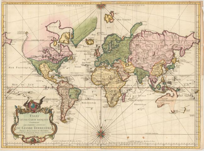
Early issue of this fine large world chart on Mercator's projection decorated with a large title cartouche and two compass roses. North America is shown with a very pronounced River of the West connecting through a series of rivers and lakes from Lake Superior to the Pacific - representing the elusive Northwest Passage. The Russian discoveries in the North Pacific are not yet shown, although there is a note about the voyages of 1743. Australia is labeled Nouvelle Hollande with Terre de Diemen and Nouv. Guinee both linked to the mainland. New Zealand is only partially formed and there are numerous islands in the Pacific. On four sheets, professionally joined.
References:
Condition: B+
Issued folding, now pressed flat, on watermarked paper with faint offsetting and a few spots scattered throughout the map. The left margin is very narrow with a portion trimmed to the neatline.