Subject: Wyoming
Period: 1916-22 (circa)
Publication:
Color:
This is a fascinating lot focused on the oil producing regions in Wyoming. The state enjoyed tremendous economic and population growth in the early 20th century fueled by its mineral resources. One of the most notable events that occurred during this boom was the infamous Teapot Dome scandal in which Secretary of the Interior Albert B. Fall leased Navy petroleum reserves to private oil companies at low rates in return for kickbacks. Fall was later convicted of accepting bribes from the oil companies, and was the first member of a President’s cabinet to go to prison for his actions while in office.
The Teapot Dome, and numerous other oil fields in the region, are the focus of the maps in this group including:
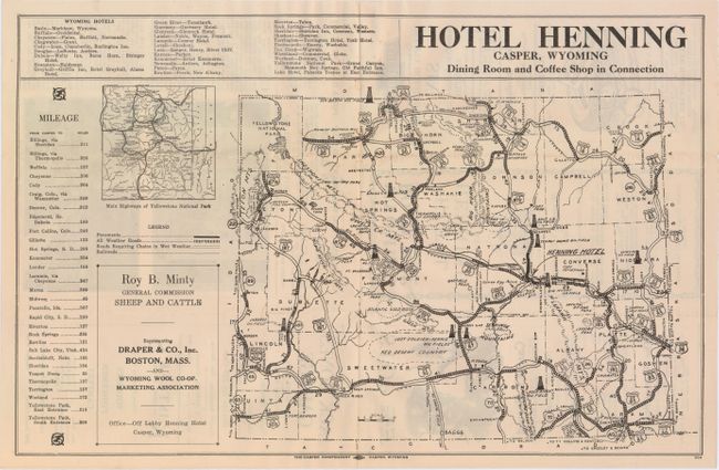
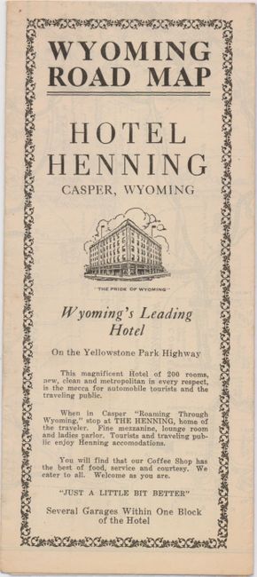
A. Wyoming Road Map, by The Casper Independent, circa 1920, black and white (17.8 x 9.8"). Rare promotional map for Hotel Henning focused on the road network in the state, including "all weather roads" and "roads requiring chains in wet weather." More interesting, however, is the identification of 11 oil fields including the Teapot Dome Oil Field close to Casper. Folds into a brochure with various advertisements on verso (4 x 9.3"). Condition: (A)
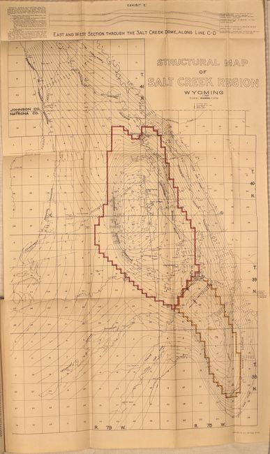
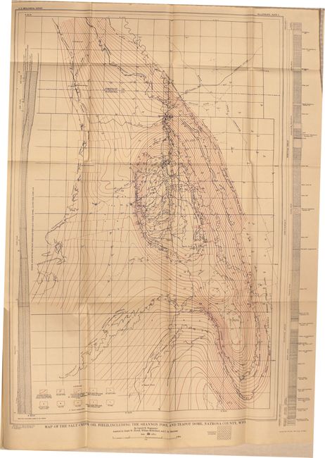
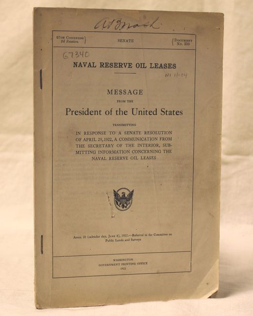
B. Naval Reserve Oil Leases, by U.S. Government, Doc. 210, 2nd Session, 67 Congress, published 1922, printed color (5.9 x 9.1"). This is Falls' 44 pp. report to the President on the leasing of oil reserves known as the Teapot Dome scandal. Includes two maps in the report, Structural Map of Salt Creek Region Wyoming showing the boundaries of the Salt Creek field and Teapot Dome, and Map of the Salt Creek Oil Field, Including the Shannon Pool and Teapot Dome, Natrona County, Wyo. Condition: Maps are clean and bright with each having a short edge tear confined to the blank margin. Report is generally good with corners slightly dog-eared. (A)
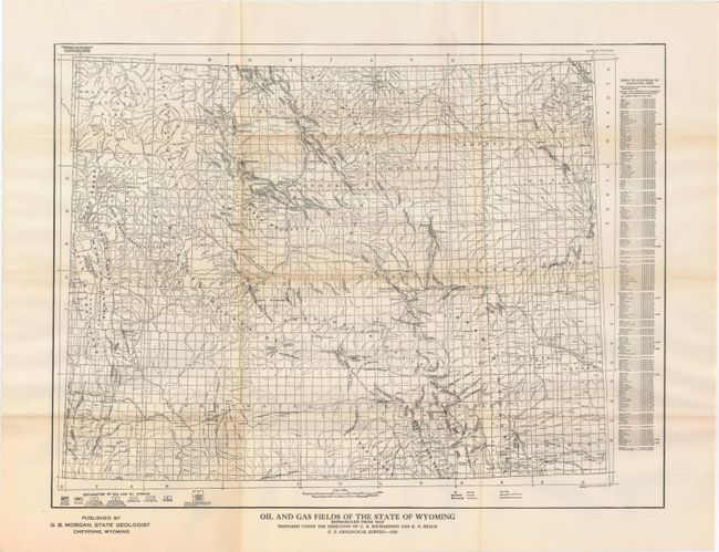
C. Oil and Gas Fields of the State of Wyoming, by U.S. Geological Survey, circa 1922, black and white (18.9 x 15.1"). Very detailed map showing oil and gas fields including those that are producing. Oil refineries are also identified. Published by G.B. Morgan, State Geologist. Condition: Issued folding on a clean sheet with faint toning along the folds and a previous owner's stamp on verso. (A)
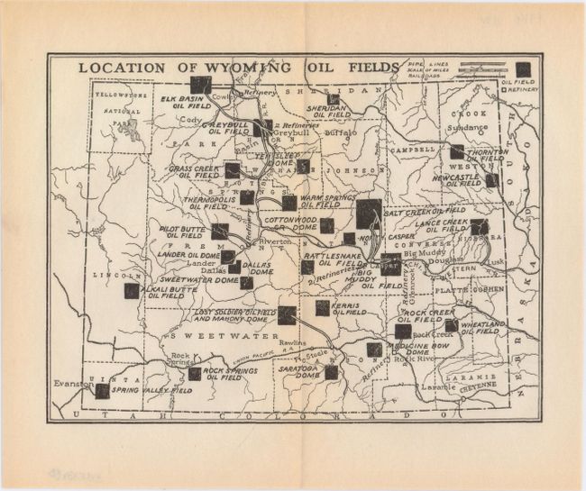
D. Location of Wyoming Oil Fields, Anonymous, circa 1919, black and white (7.4 x 5.6"). Small map showing the oil fields, pipelines and refineries in the state. The railroad network is also depicted. Condition: Watermarked paper with just a hint of toning along the centerfold. (A)
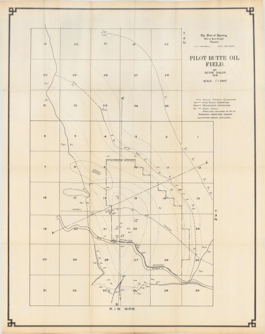
E. Pilot Butte Oil Field, by Victor Ziegler, dated 1916, printed color (21.3 x 27.3"). This map has good detail of the oil wells in the area and notes sandstone and shale formations. Contour lines are also depicted. Condition: Issued folding with one small edge tear closed on verso with archival tape. (A)
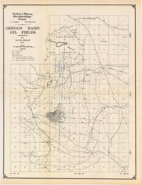
F. Oregon Basin Oil Fields, by Victor Ziegler, dated 1917, printed color (11.9 x 15.8"). Similar but smaller map to above (E) showing the oil wells and geological features of the region. Condition: Issued folding. (A)
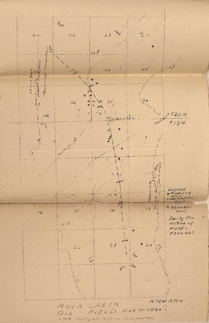
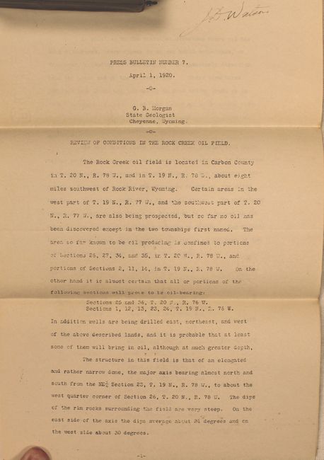
G. Rock Creek Oil Field, by G.B. Morgan, from Press Bulletin Number 7, dated 1920, black and white (6.5 x 11.5"). This is a copy of a manuscript map showing the oil wells in the region including producing wells, incomplete wells and abandoned wells. A note in the right margin shows that the daily production of this oil field is 5,700 barrels. The map is accompanied by a 5 page note describing the oil field. Condition: The lower third of the map has been fully separated and reattached with archival tape on verso. Light toning. (C+)
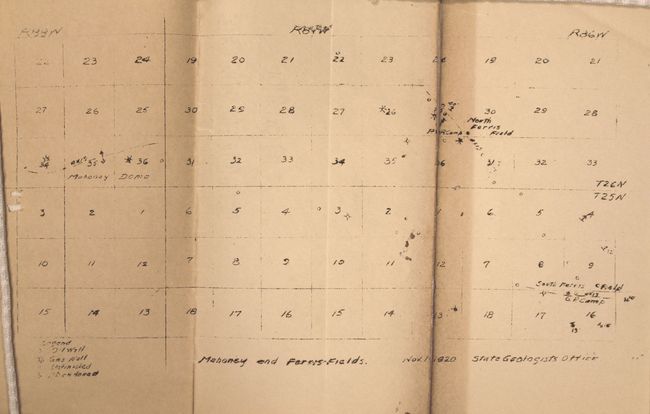
H. Mahoney and Forest Fields, by G.B. Morgan, from Press Bulletin Number 7, published 1922, black and white (6.8 x 12.0"). Another copy of a manuscript map showing the oil and gas wells in the region, noting those that are unfinished or abandoned. Condition: The lower third of the map has been fully separated and reattached with archival tape on verso with several wormholes in the image. Light toning. (C+)
References:
Condition:
See descriptions above.