Catalog Archive
Auction 148, Lot 320

"[Lot of 2] County Map of the State of Texas Showing Also Portions of the Adjoining States and Territories [and] County Map of the State of Texas Showing Also Portions of the Adjoining States and Territories", Mitchell, Samuel Augustus
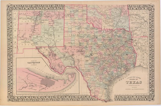
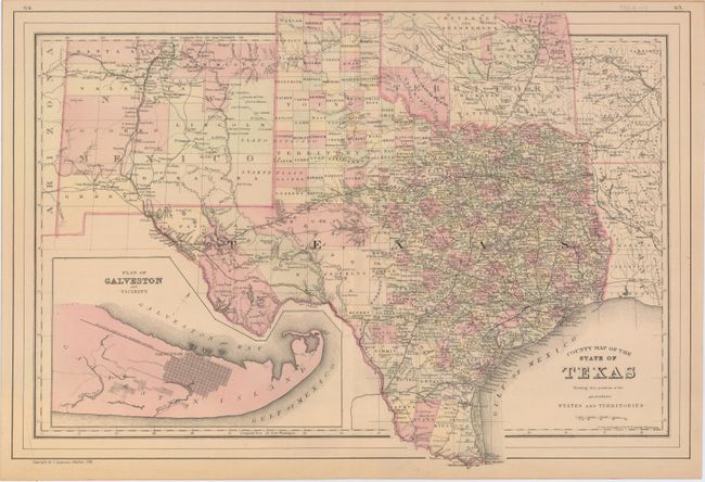
Subject: Texas

Period: 1878-84 (dated)

Publication:

Color: Hand Color

Size:
21.4 x 14.3 inches
54.4 x 36.3 cm
Download High Resolution Image
(or just click on image to launch the Zoom viewer)

This lot includes two double-page maps of Texas showing the growth of the state over a six-year period. The maps present an excellent view of the county development with only the large regions of West Texas yet to be organized. Galveston’s role as a main port of entry is obvious as it is depicted in a large inset. The Llano Estacado, or Staked Plain, is shown extending from the New Mexico Territory through the Texas panhandle. In the later map, the railroad network has extended its reach to El Paso and Laredo. Drawn and engraved in Philadelphia by W. H. Gamble.

A. County Map of the State of Texas Showing Also Portions of the Adjoining States and Territories, dated 1878.

B. County Map of the State of Texas Showing Also Portions of the Adjoining States and Territories, dated 1884.

References:

Condition: A

Nice impressions and original color with good margins.

Estimate: $275 - $350

Sold for: $180

Closed on 2/19/2014

Archived