Subject: Texas
Period: 1848-49 (dated)
Publication:
Color: Black & White
Size:
6 x 9 inches
15.2 x 22.9 cm
The Office of Coast Survey is the oldest U.S. scientific organization, dating from 1807 when Congress directed that a "survey of the coast" be carried out. By 1836, it was called the U.S. Coast Survey and in 1878, the name was changed to the U.S. Coast and Geodetic Survey. Today the Office of Coast Survey is a division of the National Oceanic and Atmospheric Administration NOAA.
The survey teams, composed of civilians as well as Army and Naval officers, charted the nation's waterways and produced a wide array of reports, survey charts, hydrographic studies of tides and currents, astronomical studies and observations, and coastal pilots. These charts are an important record of the changing nature of the nation's coastlines. In additional to coastal charts, the U.S. Coast and Geodetic Survey produced land sketches, Civil War battle maps, and the early aeronautical charts.
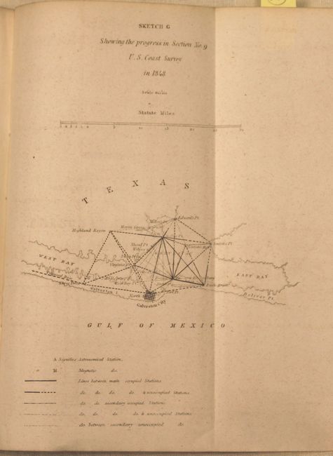
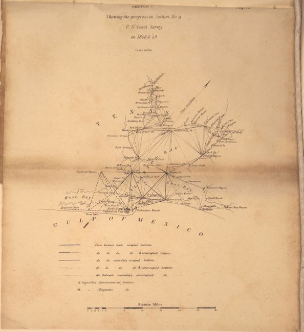
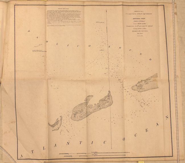
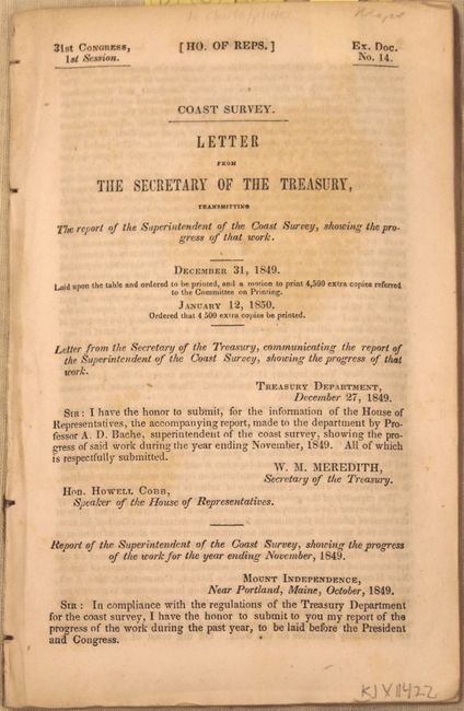
This lot includes the 1848 (HR Ex Doc No. 13, 30th Congress, 2nd Session) and 1849 (HR Ex Doc No. 14, 31st Congress, 1st Session) government reports describing the survey of the Texas coast that began in 1848 under the direction of A.D. Bache, Superintendent U.S. Coast Survey. Each includes the first published chart of the survey of the Texas coast "Sketch G Showing the progress in Section No. 9," centered on Galveston City and extending to include the West and East bays and north to Edward's Point. The end of the Mexican War and settlement in the northwest with Great Britain nearly doubled the coastline of the U.S. under the Coast Survey's charge. Surveying work began at Galveston Bay with triangulations laid out in every direction and key points determined from Galveston Bay to the mouth of the Brazos River.
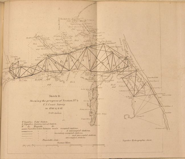
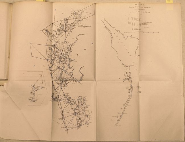
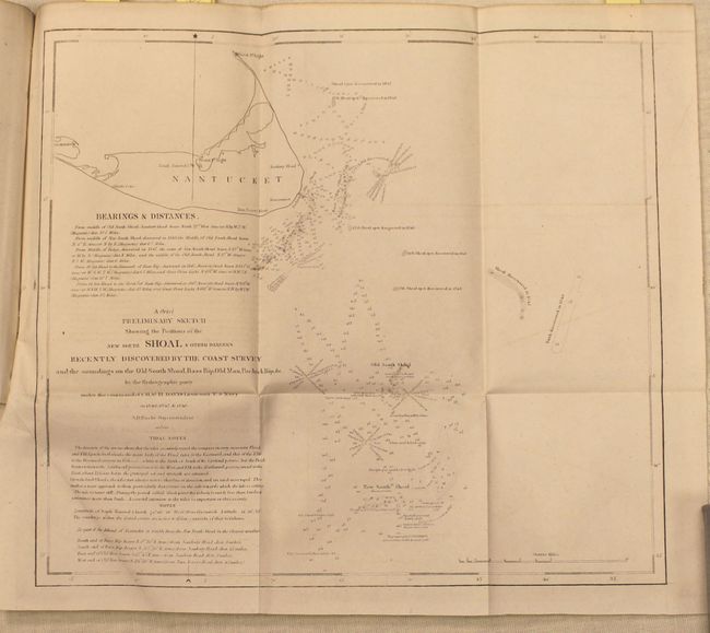
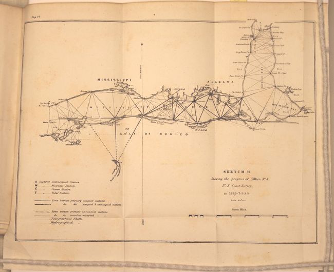
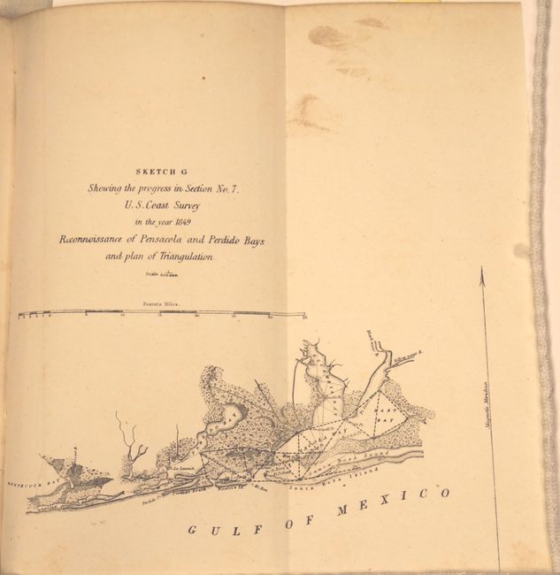
In addition to the two Galveston maps, there are 30 other charts and plates featuring Cape Cod, Nantucket, Boston Bay, Sandy Hook, Chesapeake Bay, Long Island, the Outer Banks area of North Carolina, and Charleston to name a few. 1848 edition - 120 pp.; 1849 edition -- 98 pp. Disbound. 8vo.
References: Martin & Martin, p. 147.
Condition: B
1848 edition: contents are clean and bright, with many of the charts having never been opened before. 1849 edition: contents have scattered foxing with several of the maps appearing to have never been opened before.