Subject: Lancaster, Pennsylvania
Period: 1887 (dated)
Publication:
Color: Hand Color
Size:
17.3 x 21.3 inches
43.9 x 54.1 cm
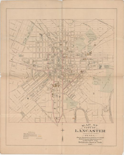
This city plan of Lancaster outlines the streets between Liberty Street in the north, South Street in the south, beyond College Avenue in the west, and to North Broad Street in the east. Public buildings (highlighted in blue), manufacturing facilities (highlighted in yellow), and available manufacturing sites are marked throughout the plan. Lancaster, named after the English town of Lancaster, was founded in 1730 and laid out by James Hamilton in 1734. The Lancaster County Prison, which was built in 1737 and styled after Lancaster Castle in England, is located at far right. The Pennsylvania iron works, an iron foundry, and a rifle works are all noted, remnants of the burgeoning iron industry and production of the Pennsylvania long rifle in the aftermath of the American Revolution. Tobacco warehouses are marked simply with a T.W. Published for the Lancaster Board of Trade.
References:
Condition: B
Issued folding with original color, a few small areas of loss at fold intersections, and numerous fold separations that have all been closed on verso with archival tape. There is light toning along one fold and a few small spots.