Subject: Oklahoma
Period: 1917 (dated)
Publication:
Color: Printed Color
Size:
50.8 x 26 inches
129 x 66 cm
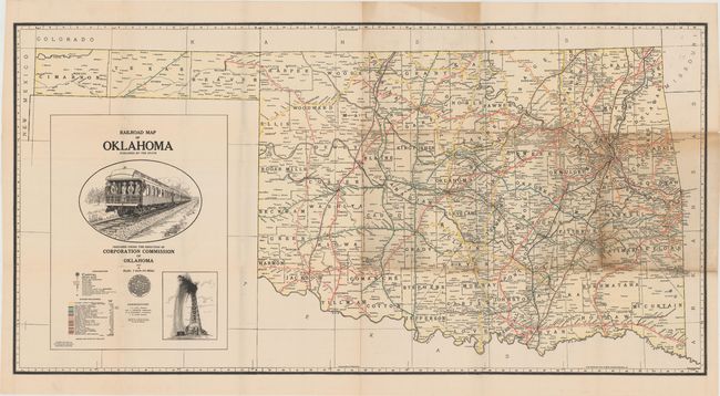
This large format map of Oklahoma depicts the expanding railroad network in the state. Twenty-one different lines are displayed including the Sante Fe Railway; the Missouri, Kansas & Texas; and the Chicago, Rock Island & Pacific. Distances are shown along the various rail lines, and the map also identifies oil and gas pipelines. Decorated by a large illustration of a rail car and a gushing oil well. Published by the engineering department of the Corporation Commission of Oklahoma.
References:
Condition: B
There are several splits at fold intersections resulting in minor image loss with some toning in the right portion of the map.