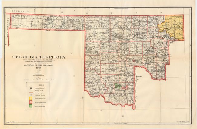
Subject: Oklahoma
Period: 1907 (dated)
Publication:
Color: Printed Color
Size:
22.1 x 13.8 inches
56.1 x 35.1 cm
A colorful map, and the last of Oklahoma Territory that details the region right before statehood. It covers present-day western Oklahoma with the panhandle, but only the western portion of the rest of the state is shown. A key at bottom identifies Indian Reserves, Military Reserves, Forest Reserves and Land Offices. Gutherie is shown as the capital. Drawn by Charles J. Helm and compiled under the direction I.P. Berthrong (1907), Chief of Drafting.
References:
Condition: A
A clean and bright example with a couple of short fold separations and a short edge tear that extends 1" into the image, all of which have been closed on verso with archival tape.