Catalog Archive
Auction 148, Lot 284

"A Plan of the Northern Part of New Jersey, Shewing the Positions of the American & British Armies, After Crossing the North River in 1776", Phillips, Richard (Sir)

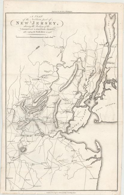
Subject: New Jersey, New York

Period: 1806 (dated)

Publication: Marshall's Life of Washington

Color: Black & White

Size:
9.9 x 15.7 inches
25.1 x 39.9 cm
Download High Resolution Image
(or just click on image to launch the Zoom viewer)

This interesting chart illustrates military activity in the region from the autumn of 1776 through the summer campaign of 1778. It extends to include Trenton and Sandy Hook, north to Tappan and Dobbs Ferry, and to New York City, Staten Island, and the western part of Long Island. The map details troop positions, roads, rivers, and mountain ranges. Scores of towns are located, including some rather odd ones: Aquakununk, Watessing, Bottlehill, Vealtown, Pluckamin, and Quibbletown. A fine Revolutionary War plan. Engraved by Neele.

References: Fite & Freeman #66.

Condition: B+

Issued folding with minor offsetting, a few extraneous creases, and a short edge tear that just enters the neatline.

Estimate: $140 - $180

Sold for: $85

Closed on 2/19/2014

Archived