Subject: Minnesota
Period: 1860 (circa)
Publication: American State Papers
Color: Black & White
Size:
18.7 x 15.2 inches
47.5 x 38.6 cm
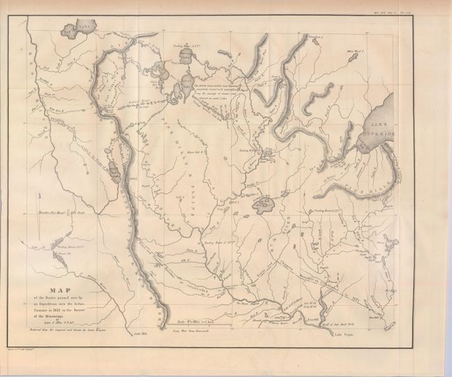
An important map, originally issued to accompany a report by Schoolcraft & Allen (HR doc 323, 23rd Cong.). It covers present-day Minnesota from the western tip of Lake Superior to the Red River. It depicts Ft. Snelling, scores of Sioux villages, trading posts of the American Fur Company and many other details. Schoolcraft led the expedition into the Upper Mississippi Valley to attempt a reconciliation between the Sioux and the Chippewa and to vaccinate the Chippewa Indians against Smallpox. In the process he found time to search for the headwaters of the Mississippi River, which led him to its source in Lake Itasca. As many of the Congressional reports written before 1833 were never printed and many never survived, this map was considered of sufficient importance to be published again in the American State Papers, a compendium of early Congressional documents.
References:
Condition: B+
Issued folding with very faint offsetting and toning.