Subject: World
Period: 1694 (dated)
Publication:
Color: Hand Color
Size:
20.9 x 14.9 inches
53.1 x 37.8 cm
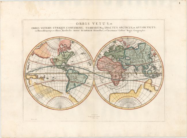
This handsome double-hemisphere world map depicts the ancient world, with classical place names in the eastern hemisphere, and just a few mythical place names in the western hemisphere. California is shown as an island, and a large, unnamed landmass appears in the north Pacific Ocean. The Great Lakes are open-ended in the west, and there are spurious mountains and rivers throughout the western hemisphere. The partially delineated outline of a large Antarctic continent fills the southern hemisphere. Australia, New Zealand, and what appears to be part of New Guinea or the Solomon Islands are also partially delineated and unnamed. Australia has a particularly odd northern coastline. This map was originally published by Sanson in 1657, and was copied for this Italian edition, published in an atlas in 1699. Engraved by Bertin.
References: Shirley #562.
Condition: A
On a bright sheet with very wide margins, some faint printer's ink residue, and a stain confined to the top blank margin.