Subject: Arizona
Period: 1901-19 (circa)
Publication:
Color:
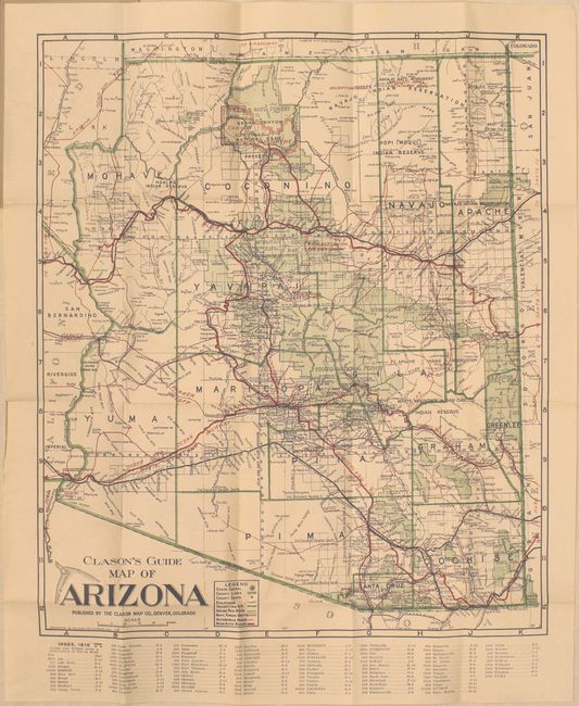
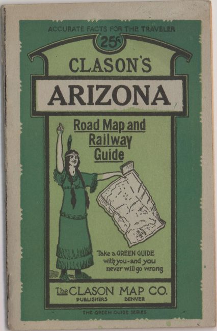
A. Clason's Guide Map of Arizona, by Clason Map Company, dated 1919, printed color (15.0 x 17.6"). This folding pocket map is complete with descriptive booklet, "Clason's Arizona Road Map and Railway Guide" (4 x 6.3"). The map delineates early Automobile Roads and Main Automobile Roads via red overprinted lines. The legend also locates the state capital (Phoenix), counties lines, county seats, railroads, rail trunk lines, Indian reservations, and National Forests. Below the map is a list of towns with populations: Phoenix had just over 30,000 people, a number that stayed small until air conditioning came into commercial use. The map shows Greenlee County, created from part of Graham County in 1909. Folds into paper covers with 24-page booklet which includes full-page city plans of Tucson and Phoenix. Condition: A clean and bright example. (A)
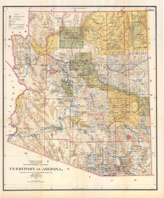
B. Territory of Arizona, by General Land Office, dated 1901, printed color (16.9 x 20.2"). A colorful and fascinating map with great detail issued eleven years before statehood. The extent of nine Indian reservations and at least three Military reservations, including Camp Apache, are clearly shown in different colors. Numerous confirmed and unconfirmed land claims are named and located. A huge Grand Canyon Forest Reserve is shown. The brown hachured mountain area and the blue waterways combine to provide great visual impact. Information includes watershed, mountains, railroads, wagon roads, private claims, unsurveyed townships, etc. A beautiful example published while Harry King was the Chief of Drafting and the Hon. Binger Hermann was commissioner. Condition: Fine. (A+)
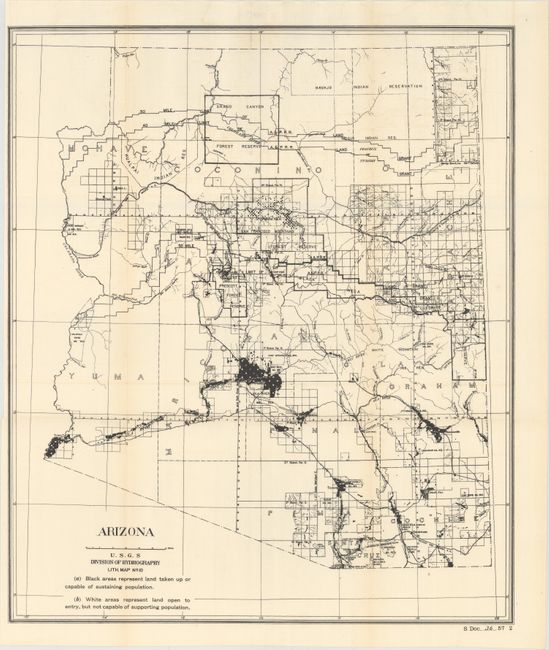
C. Arizona, by U.S.G.S, circa 1902, black and white (18.4 x 21.7"). This uncommon map accompanied the 1902 congressional report on preparations for Arizona statehood. It shows the areas that could and could not support population with the vast majority of land deemed "open to entry, but not capable of supporting population." Condition: A clean sheet with one tiny split at a fold intersection and a slightly narrow left margin due to binding trim. (A)
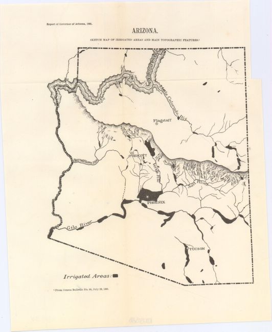
D. Arizona. Sketch Map of Irrigated Areas and Main Topographic Features, from Report of Governor of Arizona, dated 1901, black and white (6.4 x 9.0"). Smaller and more basic map as above, showing the irrigated areas of the state. Condition: Fine. (A+)
References:
Condition:
See descriptions above.