Subject: Central, Southern United States
Period: 1841 (dated)
Publication: Doc. No. 24, 27th Cong., 2nd Session
Color: Black & White
Size:
5.7 x 9 inches
14.5 x 22.9 cm
This original report contains thirteen early maps by the General Land Office. The report contains 97 pages plus a 16 page annex to the full report containing the late annual report from Arkansas.
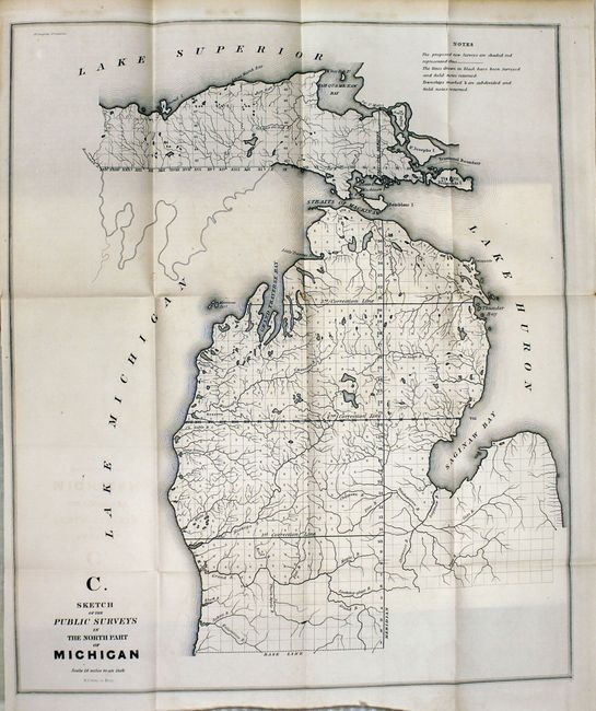
Sketch of the Public Surveys in the North Part of Michigan (15 x 17.8"). By W.J. Stone this map locates Grand Traverse Bay, Saginaw Bay, Mackinaw Island and shows good watershed detail north from the Kalamazoo River.
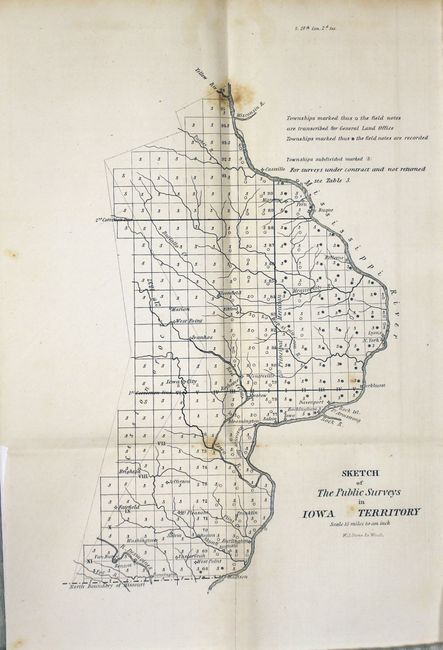
Sketch of the Public Surveys in Iowa Territory (7 x 10"). By W.J. Stone this map is centered on Iowa City and locates Salem, Bloomfield, Elkford, Davenport, etc. Good watershed detail and the progress of surveys is indicated.
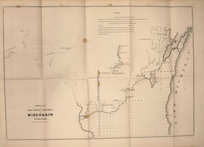
Sketch of the Public Surveys in Wisconsin Territory (19 x 13.4"). Extends from Prairie du Chien to Green Bay and also to show part of the valley of the Wisconsin River where Grigon's Trading & Farming Establishment, several mills including Conant's, and Whitneys, and Yellow Banks and Plover Portage are identified. Locates the lands of the Stockbridge and Oneida Indians.
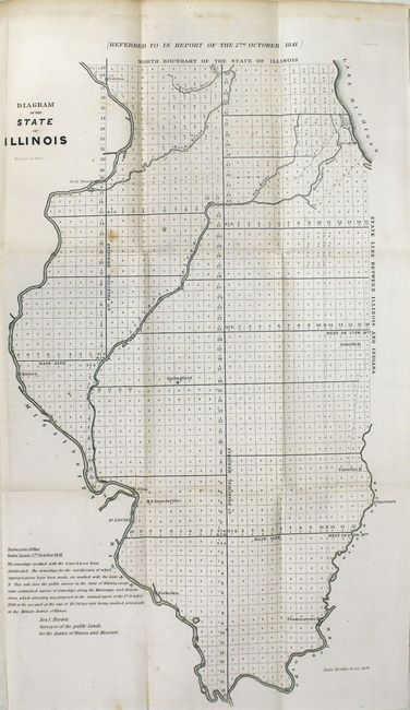
Diagram of the State of Illinois (12 x 21.5"). Shows the entire state with townships. Major towns are located.
Diagram of the State of Missouri, 1841 (21 x 17"). Shows the entire state with townships. Major towns are located.
[Four maps of Louisiana] Map of the South Western District (10 x 13.5") ; South Eastern District (10 x 8") ; Map of the District North of Red River (9.5 x 8.5") ; and St. Helena District (8 x 5"). Each township is noted.
Diagram of he Surveying District South of Tennessee (11 x 16.5"). Centered on Jackson the map names Grand Gulf, Natches, Vicksburg, Granada, and Columbus. Good detail of the Pascagoula, Pearl, Big Black and Yallobusha rivers. Locates the Choctaw Cession of 1830 and the Old Choctaw Boundary.
A Diagram of the State of Alabama (11.5 x 22.7").
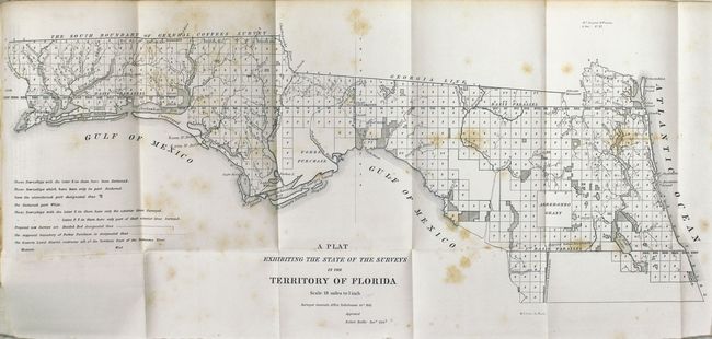
A Plat Exhibiting the State of the Survey in the Territory of Florida (23 x 10"). This early, interesting map shows the status of public land surveys in the Eastern and Western Land Districts of the Florida Panhandle. The boundary of the Forbes Purchase is shown. St. Augustine, Amelia Island, and Tallahassee are named. From the Surveyors Office in Tallahassee by Robert Butler Survey General Territory of Florida.
Arkansas, 1841, (17 x 15").
References:
Condition: B
There is some scattered foxing to the maps with light toning and foxing to the text.