Subject: Southern United States
Period: 1788 (dated)
Publication:
Color: Hand Color
Size:
19.5 x 12.3 inches
49.5 x 31.2 cm
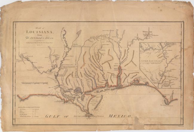
This is the English version of D'Anville's 1732 Carte de la Louisiane, drawn by Haywood and engraved by Bowen. The map focuses on the Mississippi delta, showing the Red River as far as Adayes, a Spanish garrison of the Province of Tecas. The coastal area extends in the east from Cape San Blas and Apalachicola Bay (C. Escondido) to an area named Cabo del Norte shown with a small island off the cape. It names New Orleans, Fort Conde, Pensacola, Fort Louis and Mobiliens. The northern portion of Louisiana Territory is portrayed in an inset. The map has many notations of towns destroyed by battles, both Indian and French.
References: Sellers & Van Ee #1616; cf Lemmon, Magill & Wiese, Charting Louisiana #24.
Condition: C+
Moderate toning and a few spots of foxing with a centerfold separation at bottom that extends 1" into the image and has been closed with archival tape. A small 1" x 1" chip in an unengraved portion of the map at bottom has been replaced with old paper.