Catalog Archive
Auction 148, Lot 190

"The Bay of Chesapeake, from Its Entrance to Baltimore", Blunt, Edmund

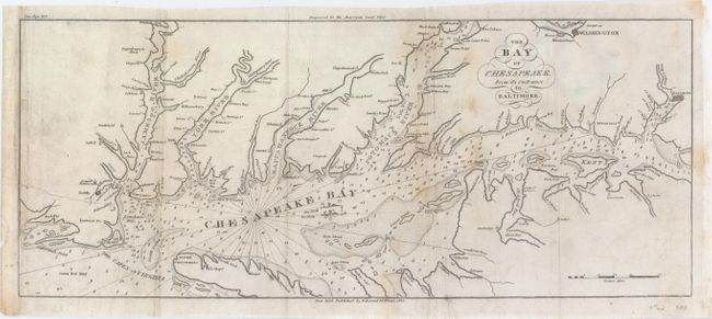
Subject: Chesapeake Bay

Period: 1815 (dated)

Publication: The American Coast Pilot

Color: Black & White

Size:
17.2 x 7.2 inches
43.7 x 18.3 cm
Download High Resolution Image
(or just click on image to launch the Zoom viewer)

This chart details the Chesapeake Bay from the Currituck Inlet north to Baltimore. It is filled with shoals and soundings, many of which extend into the James, York and Potomac Rivers. The map is oriented with north to the right and shows both true and magnetic North. Issued in the eighth edition of the Coast Pilot.

References:

Condition: B

Issued folding and now flattened and backed with tissue to reinforce and repair a tear that enters 3" into map at left. Remargined at left with a small portion of neatline in facsimile. Occasional toning and light soiling, primarily along the folds.

Estimate: $150 - $200

Sold for: $110

Closed on 2/19/2014

Archived