Subject: Mid-Atlantic United States
Period: 1904 (dated)
Publication:
Color: Black & White
Size:
31.9 x 63.1 inches
81 x 160.3 cm
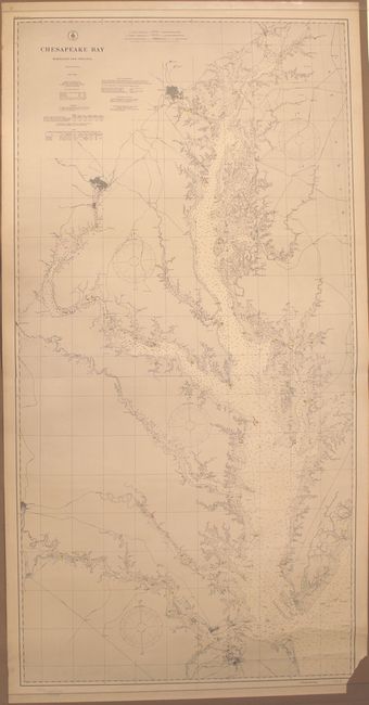
This large format map, printed and joined on two sheets, shows incredible detail of the Chesapeake Bay from Norfolk, Virginia north to Havre de Grace, Maryland. The chart extends west and north following the James, Potomac and Patapsco Rivers to Richmond, Washington D.C. and Baltimore respectively. The bay is filled with soundings and buoys while lighthouses are noted along the coast at Cape Charles, Cape Henry and Hog Island. A stamp at bottom notes that while the map is dated 1904, it has been corrected to 1906 with "Aids to Navigation corrected for information received to August 27, 1906."
References:
Condition: B+
There is a small area of loss at bottom right and one short edge tear at top confined to the blank margin and closed on verso with archival tape. Otherwise a nearly fine example.