Subject: Mid-Atlantic United States, Virginia, Civil War
Period: 1863 (dated)
Publication:
Color: Printed Color
Size:
22.4 x 22.3 inches
56.9 x 56.6 cm
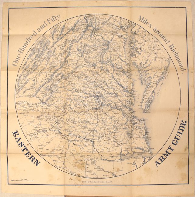
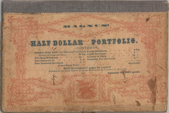
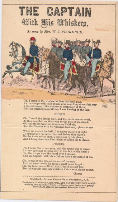
This scarce Civil War map focuses on the center of action in Virginia. It covers the region from Baltimore south to Raleigh and from the Chesapeake Bay to Lexington, Virginia. Details include roads, railroads, cities, courthouses, rivers and topography. The map is attached to its original stiff boards and includes an 1863 almanac (calendar) and a hand-colored song sheet entitled "The Captain With His Whiskers" which came with the 5.5 x 8.5" portfolio. The front cover gives a list of the contents which includes these described items only with a note "Almanac for 1863 Gratis" which helps to positively date the map. Stephenson does not list this edition, but the 1863 date and lack of inset maps and illustrations around the map itself likely make this an early edition. As stated on the cover, this portfolio and its contents were " published for the Union soldiers by Charles Magnus."
References:
Condition: B
The map has scattered foxing and staining with a few tiny splits at fold intersections that have been closed on verso with archival tape. Covers have light wear and stains.