Subject: Mid-Atlantic United States
Period: 1862-64 (circa)
Publication:
Color: Hand Color
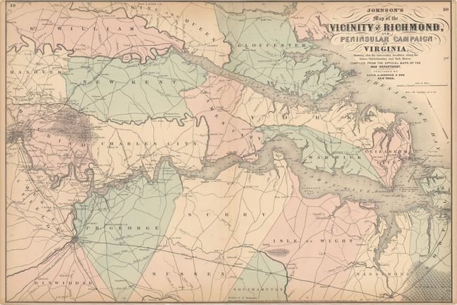
A. Johnson's Map of the Vicinity of Richmond, and Peninsular Campaign in Virginia. Showing Also the Interesting Localities Along the James, Chickahominy and York Rivers..., dated 1862 (26.6 x 17.9"). A very interesting Civil War map that was compiled from the Official Maps of the War Department. This well-engraved map covers the region of the James, Chickahominy and York Rivers, and includes the cities of Norfolk, Richmond, and Petersburg. The map shows great detail of military movements, lines and fortifications. It notes the location of the "contest" between the Monitor and Merrimac on 9 March 1862, the Confederate evacuation of Yorktown, May 4 1862, the battle in the vicinity of Williamsburg, May 5 1862, the battle of Malvern Hill and several other military engagements in the vicinity of Richmond. Condition: There are a few tiny edge tears and light toning along the top edge of the sheet. Narrow margins as issued. (B+)
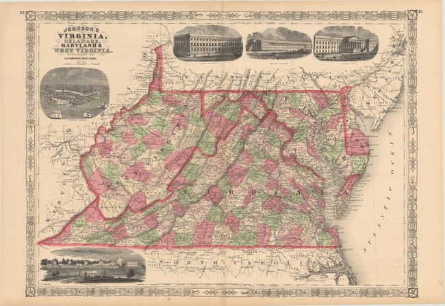
B. Johnson's Virginia, Delaware, Maryland & West Virginia, dated 1864 (23.2 x 17.0"). A very graphic and attractive double-page map filled with detail of railroads, roads, towns, villages and topographical information. With a large vignette birds-eye-view of Fort Monroe and the University of Virginia. Decorative borders. Condition: Faint toning along the centerfold with a centerfold separation at bottom confined to the blank margin. (A)
References:
Condition:
See descriptions above.