Catalog Archive
Auction 148, Lot 179

"Rhode-Island and Connecticut", Morse, Jedidiah (Rev.)

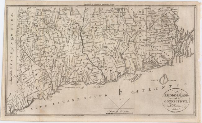
Subject: New England United States

Period: 1796 (published)

Publication: The American Universal Geography

Color: Black & White

Size:
13.2 x 7.7 inches
33.5 x 19.6 cm
Download High Resolution Image
(or just click on image to launch the Zoom viewer)

This early map of Rhode Island and Connecticut was published in Morse’s The American Universal Geography. The map depicts counties, townships, rivers and numerous small lakes and ponds. In the west the Oblong is shown, which was a 2 by 50 mile stretch of land given to New York in return for Connecticut’s boundary extending westward along Long Island Sound. Drawn by Harding Harris and engraved by Samuel Hill.

References: Wheat & Brun #287.

Condition: B+

Issued folding and now flattened with a few minor spots and light toning along one fold.

Estimate: $160 - $200

Sold for: $130

Closed on 2/19/2014

Archived