Subject: Colonial New England & Mid-Atlantic United States
Period: 1757 (dated)
Publication: Prevost's Histoire Generale des Voyages
Color: Black & White
Size:
11.7 x 8.1 inches
29.7 x 20.6 cm
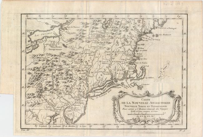
This French & Indian War period map details the English colonies from Pennsylvania through to Castine, Maine, with their early boundaries. It is fully engraved with topographical features and includes many early place names. The colonies are shown confined east of the Allegheny Mountains with the Nations Iroquoises, Indian villages, and several French forts located west of the mountains. It extends to show Lake Ontario and most of Lake Erie. A flourishing French rococo-style cartouche with distance scale decorates the map.
References: McCorkle #757.1; Sellers & Van Ee #721.
Condition: A
Issued folding on watermarked paper with faint offsetting, a few minor misfolds, and a tear confined to the top blank margin that has been closed on verso with archival tape.