Subject: Eastern United States
Period: 1800 (circa)
Publication: The New Universal Gazetteer
Color: Black & White
Size:
12.8 x 10 inches
32.5 x 25.4 cm
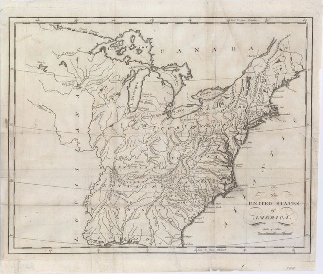
This map of the young United States covers the region from Maine south to Florida and west to the Mississippi River. Georgia's western boundary extends to include present-day Alabama and Mississippi. Several spurious islands are located in Lake Superior including I. Royal. Vermont is not named. Inland detail is limited to rivers, topography and some place names. The map is accompanied by five pages of related text describing the land, population and trade.
References:
Condition: B
Issued folding and now flattened and professionally backed with tissue to repair and reinforce numerous fold separations and a 5" edge tear at right. Light soiling.