Subject: United States
Period: 1884-99 (circa)
Publication:
Color: Printed Color
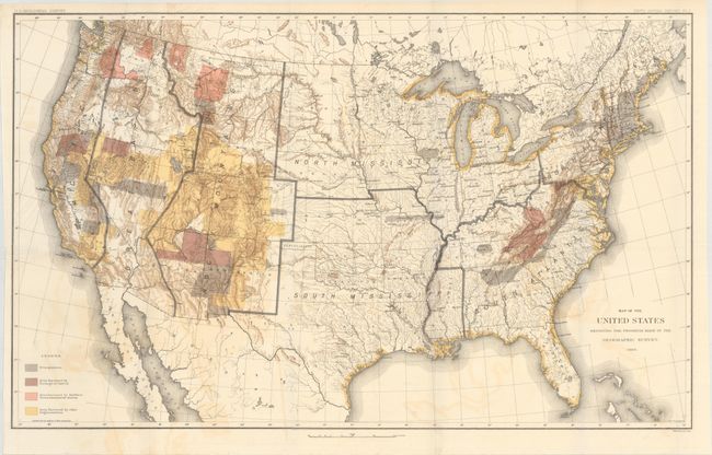
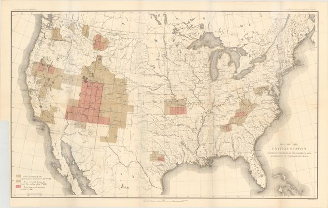
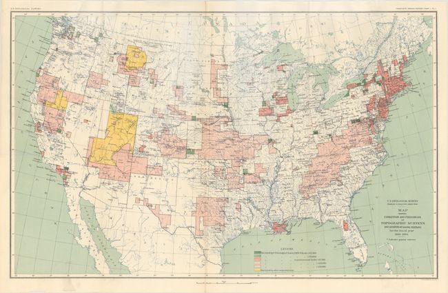
These three maps show the evolution of surveying by the USGS over a fifteen-year period (1884-1899) including:
A. Map of the United States Exhibiting the Progress Made in the Geographic Survey, from Fifth Annual Report, dated 1884 (28.3 x 17.4"). Surveying is focused on the western states including Colorado, Utah, Nevada and California. The legend shows four different surveys: Triangulation, Area Surveyed by Geological Survey, Area Surveyed by Northern Transcontinental Survey, and Area Surveyed by other Organizations. Condition: There is some light color offsetting and some extraneous creasing at left. (B+)
B. Map of the United States Showing Progress in Preparation and Engraving of Topographic Maps, from Seventh Annual Report, circa 1886 (28.3 x 17.3"). Depicts the extent of surveying at the close of the fiscal year 1886. Surveyed areas include the southern Appalachians, the Great Basin, California and Washington state. Condition: There is a small stain in Nevada at the fold and a binding trim at lower left. (B+)
C. Map Showing Condition and Progress of Topographic Surveys and Location of Gaging Stations for the Fiscal Year 1898-1899, from Twentieth Annual Report, circa 1899 (28.2 x 17.4"). Additional surveying is seen especially in the middle of the country in Kansas, Missouri and Oklahoma. Gaging stations are also identified. Condition: A clean, bright example. (A)
References:
Condition:
See descriptions above.