Catalog Archive
Auction 148, Lot 114

"Carte de l'Acadie, Isle Royale, et Pais Voisins. Pour Servir a l'Histoire Generale des Voyages", Bellin, Jacques Nicolas

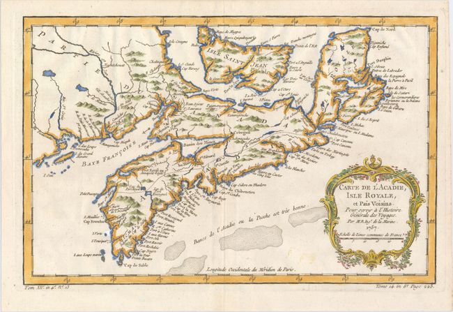
Subject: Nova Scotia, Canada

Period: 1757 (dated)

Publication: La Harpe's Histoire Generale des Voyages

Color: Hand Color

Size:
13 x 8.4 inches
33 x 21.3 cm
Download High Resolution Image
(or just click on image to launch the Zoom viewer)

This strongly engraved map by Bellin covers all of Nova Scotia including Cape Breton. Prince Edward Island, here called Isle Saint Jean, is shown in good detail, and Nova Scotia is in part named as Acadie. South of Nova Scotia numerous banks are noted where 'la Pesche est tres bonne' (the fish are very good). The Micmac tribe is named near Shelburne. This map was published shortly after the 1755 expulsion of Acadians from this region. Although the Acadians were able to come back in 1764, many had settled in Louisiana and did not return.

References: Kershaw #783.

Condition: A

There are a couple small faint spots, else fine.

Estimate: $160 - $190

Sold for: $150

Closed on 2/19/2014

Archived