Subject: Newfoundland, Canada
Period: 1744 (dated)
Publication: Allgemeine Geschichte…
Color: Hand Color
Size:
14.1 x 11.3 inches
35.8 x 28.7 cm
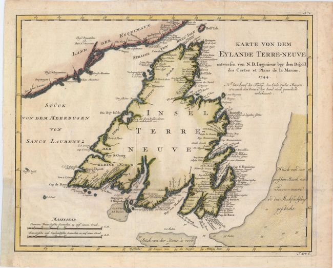
Fine copper engraved chart of Newfoundland, with the coast of the mainland at upper left. Blank interior, but there is good detail along the coastlines with scores of place names. The Strasse von Bell' Isle and part of the Gulf of St. Lawrence are noted. Shoals and fishing banks are indicated through full stippling in the sea, with soundings marked. There are two scales of miles at lower left. Dated 1744, but published in 1756 in the German edition of Bellin's Histoire et Description Generale de la Nouvelle France by Arkstee & Merkus.
References: Kershaw #516.
Condition: B+
Issued folding, now pressed on watermarked paper with a few light stains and offsetting with a binding trim at left that has been replaced with old paper.