Subject: Eastern Canada
Period: 1782-1865 (circa)
Publication:
Color:
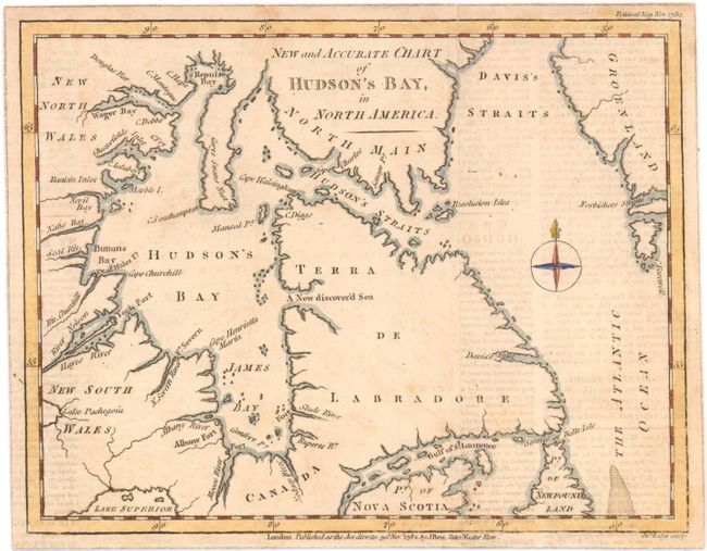
A. New and Accurate Chart of Hudson's Bay, in North America, by John Lodge, from Political Magazine, dated 1782, hand color (9 x 7"). Attractive, small map describing the James and Hudson Bays, the St. Lawrence, and part of Nova Scotia, Labrador, Hudson Strait, Repulse Bay, and Greenland. There is a hopeful, but spurious, New discover'd Sea located on the western coast of Labrador. The map is decorated with a compass rose. This map was created by John Lodge for publication in the Political Magazine of 1782. References: Jolly #POL-64; Kershaw #481. Condition: Slightly uneven impression at bottom with some text transfer from an opposing page. (B)
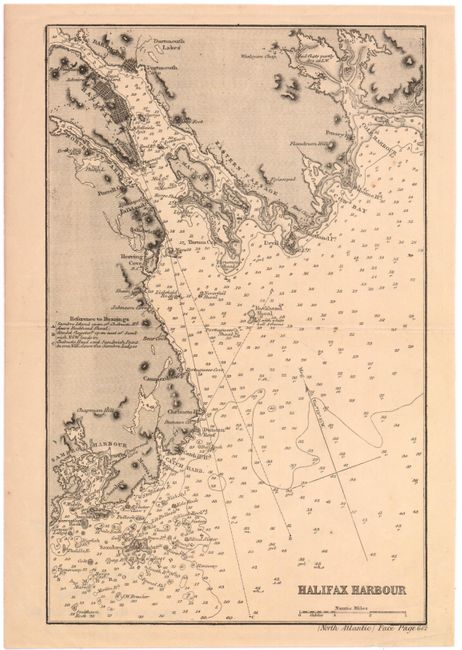
B. Halifax Harbor, by James Imray, circa 1835, black & white (6.3 x 10"). Detailed chart of the harbor shows block plans of Halifax & Dartmouth. Depicts the Eastern Passage and the Northwest Arm, McNab Island and the coast down to Duncan Reef, Catch Harbor and Sambro Harbor. Hundreds of depth soundings are indicated throughout and includes Rockhead and Neverfail shoals at the harbor entrance, with courses and variations. Condition: Light toning. (B+)
References:
Condition:
See description above.