Subject: North America
Period: 1810-52 (circa)
Publication:
Color: Hand Color
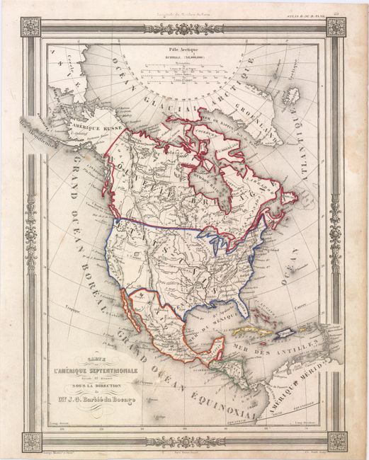
A. Carte de l'Amerique Septentrionale, by Jean-Guillaume Barbie du Bocage, circa 1852, hand color (9.1 x 12.1"). This decorative map stretches from the Arctic Ocean to the northern part of South America, with many cities identified east of the Mississippi, as well as rivers and mountains. Within the United States, Indian Territory is here called Distict d'Ozark. Alaska is Amerique Russe. The map is decorated by a picture-frame style border and elegant scroll titling. Engraved by Charles Smith. Condition: Original outline color with some soiling, a tiny wormhole only visible when held up to light, and two small abrasions, the first on the "C" in "Grand Ocean Equinoxial", and the second on the border near the bottom left corner.
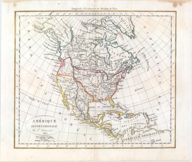
B. Amerique Septentrionale, by Felix Delamarche, dated 1824, hand color (12.2 x 10.4"). This fascinating French map of North America features the United States in an evolving configuration. Mexico has control of an unnamed Texas and the rest of the Southwest. The northwest United States extends into present-day British Columbia due to the Fifty-four Forty or Fight! dispute. Farther north, Alaska is identified as Amerique Russe and borders Nouveau Cornouailles. Condition: There is slight toning along the centerfold, two short centerfold separations at top and bottom that have been professionally repaired on verso, and some stains on the top edge, well away from the map.
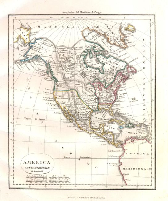
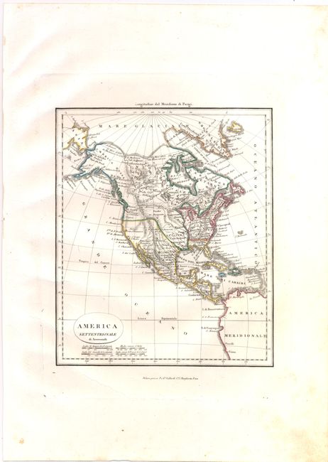
C. America Settentrionale di Arrowsmith, circa 1810, hand color (7.9 x 9.3"). Uncommon, small Italian map based on Arrowsmith's important map of North America. The area shown extends to include Central and South America to Lima. Numerous Indian tribes are located throughout. Baffin Bay is delineated much too large with a note about the Hearne (1771), Foxe (1631), and Mackenzie (1789) expeditions in that region. America Russa (Alaska) is shown in an early configuration. The United States are shown incorrectly to include part of eastern Canada and the Midwest, and much of Canada is shown as French possessions, likely a mistake made by the colorist because there is no engraved border on the map. Colorists during this period were often young children and mistakes were common on this type of map. Published in Milan by Pietro & Giuseppe Vallardi. Condition: Nice impression with wide margins and a few extraneous creases in the lower left portion of the image.
References:
Condition: B+
See descriptions above.