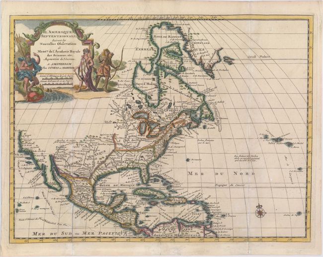
Subject: North America
Period: 1735 (circa)
Publication: Nouvel Atlas
Color: Hand Color
Size:
11.6 x 8.7 inches
29.5 x 22.1 cm
A delicately engraved map of North America and the West Indies, based on Delisle's important map of 1700. This map depicts an interesting version of California that is ambiguous about whether it is an island or not, as the Gulf of California is left open ended, and the Northwest coast is left blank. Neptune and two Native Americans flank the large title cartouche. The routes of the explorers Cortez, Drake and Olivier are shown in the Pacific. This map was originally published by Pieter van der Aa.
References:
Condition: B+
Issued folding, now pressed, on watermarked paper with original outline color and later coloring in the cartouche. There is light toning and soiling along the folds, and several fold separations have been professionally repaired. A tiny hole in northern South America has also been professionally repaired, with a tiny amount of image replaced in facsimile.