Subject: Western Hemisphere
Period: 1800 (dated)
Publication:
Color: Hand Color
Size:
25.7 x 20 inches
65.3 x 50.8 cm
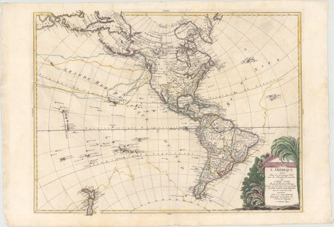
This large, rare map of the Americas extends to show New Zealand, a portion of northeastern Asia, and part of Japan. Within the United States, important cities and settlements such as Jamestown, Philadelphia, Boston, Charleston, and New Orleans are identified, as are the locations of several Indian tribes. Cook's discoveries in Hawaii and Alaska are reflected within the map, as are his routes throughout the oceans. John Meare's routes appear near Alaska, and the northwest coast is presented in Meare's configuration with a Sea of the West (Vue de la Terre la Mer la Mer). In addition to Hawaii, many other islands in the Pacific are also included. The Caribbean and South America are rendered in fine detail. A decorative title cartouche featuring indigenous vegetation adorns the bottom right corner.
References: McGuirk #235.
Condition: B+
On watermarked paper with sizable margins and printer's ink residue. There is also a printer's crease and two marginal tears that have been closed on verso with Japanese tissue.