Subject: Reference Books
Period: 1989-95 (published)
Publication:
Color: Black & White
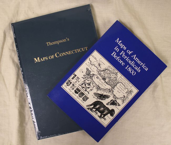
A. Maps of America in Periodicals Before 1800, by David C. Jolly, published 1989 (6.1 x 9.0"). An excellent source for older material, this guide is comprised of 465 entries, and is indexed by place, publisher, and the periodical it came from. In the preface, the author states that "It was noticed that many dealer catalogs did not attribute maps from 18th-century periodicals with the same accuracy as for maps from atlases." This excellent booklet is a thorough and well executed resource for these types of maps. 120 pages. Soft covers.
B. Thompson's Maps of Connecticut, by Edmund Thompson, published 1995 (7.4 x 10.8"). Reprint of this interesting, scholarly work that is extremely rare in the original edition. As the publisher of this reprint states, "There are few great America carto-bibliographies and Thompson's Maps of Connecticut is one of them. Unfortunately, this insightful work is almost unknown because of its extreme scarcity!" Two volumes in one. Vol.1 includes maps before the year 1800; Vol. 2 includes maps for the years 1801-1860. 177 pp, illustrated. Hardbound in dark blue buckram.
References:
Condition: A+
<i>Thompson's Maps of Connecticut</i> is in shrink wrap.