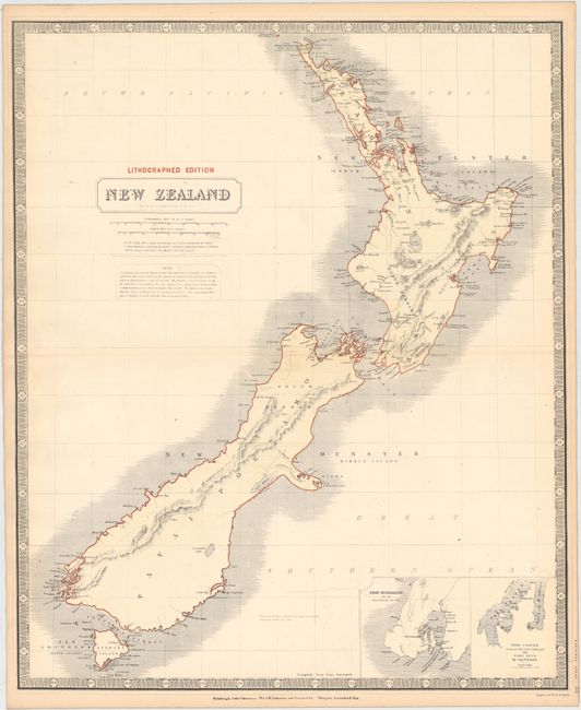
Subject: New Zealand
Period: 1845 (circa)
Publication: National Atlas
Color: Printed Color
Size:
20 x 23.5 inches
50.8 x 59.7 cm
A large map of New Zealand showing the early, transitional provinces of New Ulster, New Munster and New Leinster. These divisions were created in 1841 and abolished in 1853. The islands are also carrying their Maori names of Tavai Poenamo for the Middle Island, and Eaheino Mauwe for the North Island. The inset at lower right has small maps of Port Nicholson and Lyttelton, formerly called Port Cooper. From Johnston’s early lithographed edition of his National Atlas.
References: cf. Tooley (Australia) #764.
Condition: B+
There is a 2" tear at center that has been professionally repaired and light toning along the edges of the sheet.