Catalog Archive
Auction 147, Lot 699

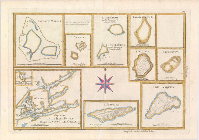
"Esquisse de la Baye Dusky dans la Nouvelle Zeelande [on sheet with] I. Pitcairn [and] I. De Pasques [and] Isles de Wallis [and] I. Turtle [and] I. des Cocos ... I. des Traitres... [and] Palmerston I. [and] I. Sauvage [and] I. d' Hervey", Bonne, Rigobert

Subject: New Zealand

Period: 1783 (circa)

Publication: Atlas Encyclopedique

Color: Hand Color

Size:
13.6 x 9.3 inches
34.5 x 23.6 cm
Download High Resolution Image
(or just click on image to launch the Zoom viewer)

In addition to the map of Dusky Bay with an inset of Pickersgill Harbour, this interesting sheet includes eight small charts of islands in the Pacific Ocean as described by Captain James Cook on one of his expeditions between 1768-1775. Dusky Bay was first sighted by Captain Cook during his first voyage to New Zealand in 1770. On his second expedition he spent two months exploring the sound, and used it as a harbor, establishing workshops and an observatory. The map was engraved by Gaspard Andre.

References:

Condition: B+

On watermarked paper with a few small weak spots in the paper that have been reinforced on verso with archival material.

Estimate: $140 - $170

Sold for: $80

Closed on 11/20/2013

Archived