Subject: Southern Africa
Period: 1739-60 (circa)
Publication:
Color: Hand Color
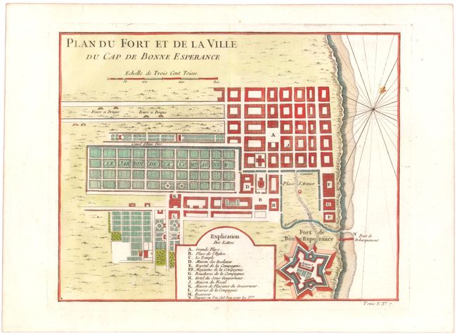
A. Plan du Fort et de la Ville du Cap de Bonne Esperance, circa 1760 (10.4 x 8.1"). Detailed plan of the Dutch fort and settlement at the Cape of Good Hope showing the town and fort with a key at bottom listing fourteen important locations.
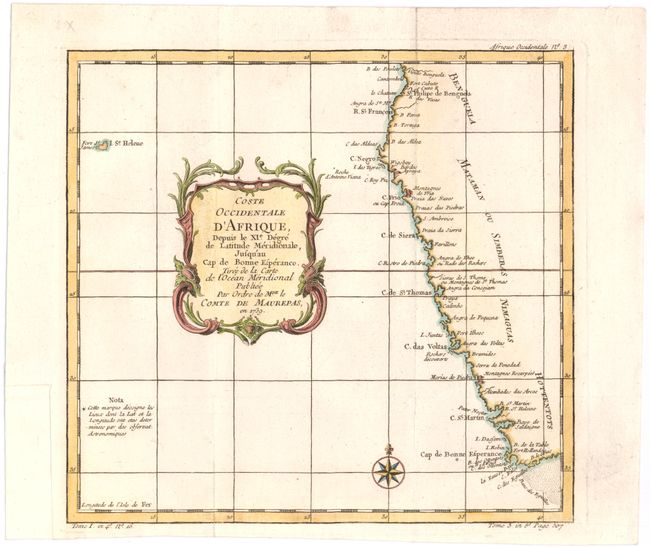
B. Coste Occidentale d'Afrique, Depuis le XIe. Degre de Latitude Meridionale..., dated 1739 (10.3 x 9.7"). Covers the southwestern coast of Africa extending from Benguela to the Cape of Good Hope, presenting coastal detail only. The map extends west to include St. Helena island. Adorned with a decorative title cartouche and a compass rose. Condition: Issued folding with a binding trim at bottom left that has been professionally replaced with old paper.
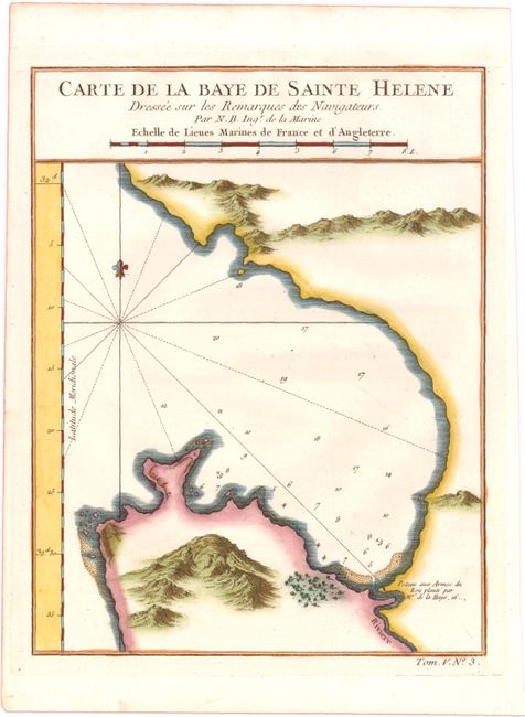
C. Carte de la Baye de Sainte Helene Dressee sur les Remarques des Navigateurs, circa 1760 (6.4 x 8.3"). This chart of St. Helena Bay, just north of Cape Town, shows soundings, safe anchorages, shoals, and the topography of the coastline.
References:
Condition: A
Bright clean examples on watermarked paper. See description above for additional details.