Subject: Africa
Period: 1616 (published)
Publication: Tabularum Geographicarum Contractarum
Color: Hand Color
Size:
5.3 x 3.8 inches
13.5 x 9.7 cm
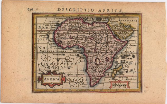
A reduced version of Hondius' superb map of the continent. It is based on the Mercator model with revisions to the coastlines, particularly that of Madagascar. Hondius improved the Cape area by inserting C. Falco and discarding Cayneca. In western Africa, the Niger River flows in a fairly straight line to the Atlantic, and two large lakes south of the equator are shown as the source of the Nile River. The map is crisply engraved and decorated with strapwork title and distance scale cartouches. Latin title page on verso.
References: Betz #56; King (2nd ed.) pp. 96-99; Van der Krogt (Vol. III) #8600:342.
Condition: B+
A nice impression with attractive color and light toning.