Subject: Central Asia
Period: 1730 (published)
Publication: Claudii Ptolemaei's Atlas Tabulae Geographicae Orbis Terrarum
Color: Hand Color
Size:
15.9 x 13.6 inches
40.4 x 34.5 cm
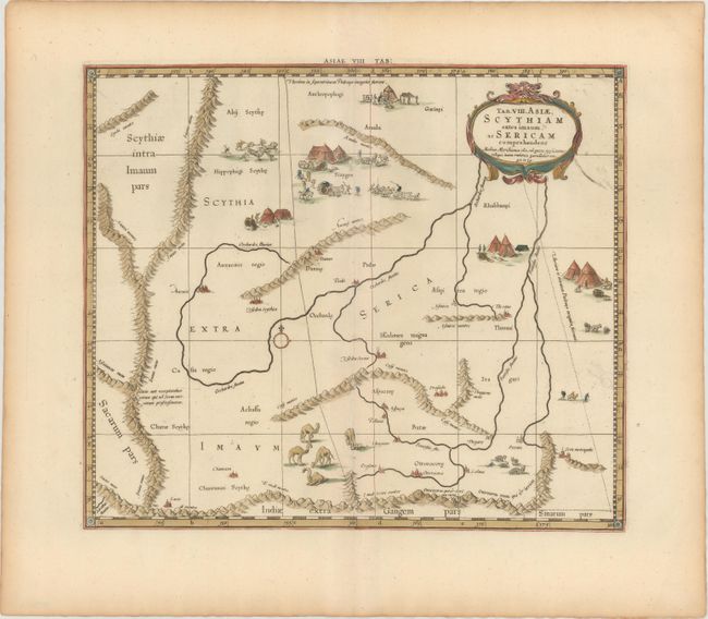
This fine copper engraved map covers Central Asia east of the Caspian Sea in what is now Tajikistan, Kyrgyzstan and western China. The Himalayas and Northern India run across the bottom of the map. The map includes several quaint scenes of the local people, encampments, camel herds, and the capture of wild horses. Mercator originally published this map in his 1578 edition of Ptolemy's great Geography. Although he is most renowned today for the projection he popularized and for first using the term Atlas for a collection of maps, he devoted much of his life to his Ptolemaic maps. The maps were beautifully engraved as nearly as possible to their original form and embellished with fine cartouches. This is the third state with a re-engraved title cartouche and the addition of a grid, published by R. and J. Westenios and Guil. Smith.
References: Mickwitz & Miekkavaara #235-14; Van der Krogt (Vol. I) #0928:1.3.
Condition: A
Nice impression and color on watermarked paper with a printer's crease adjacent to centerfold, a few spots of printer's ink residue, and light toning along sheet edges, far from image.