Catalog Archive
Auction 147, Lot 564

"A New Map of the Western Parts of Asia Minor Largely Taken: Shewing Their Antient Divisions, Countries or People, Chiefe Cities, Towns, Rivers, Mountains &c.", Wells, Edward

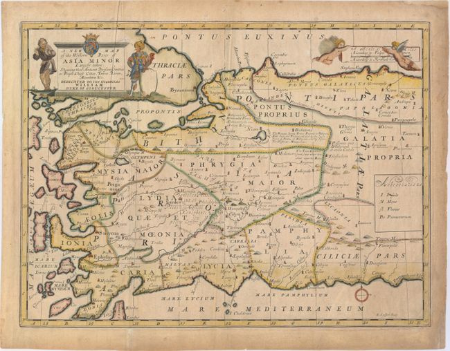
Subject: Western Turkey

Period: 1701 (circa)

Publication: A New Sett of Maps both of Antient and Present Geography

Color: Hand Color

Size:
19.3 x 14.4 inches
49 x 36.6 cm
Download High Resolution Image
(or just click on image to launch the Zoom viewer)

This handsome map covers the western portion of present-day Turkey. Ancient political divisions and the locations of historically important places are shown. The map is decorated with a figurative cartouche that includes the arms of William Henry, Duke of Gloucester, who was a student of Wells at Oxford. Engraved by R. Spofforth.

References: Shirley (BL Atlases) T.WELL-1a #31.

Condition: B+

Watermarked paper with light toning and soiling, a printer's crease at left, and several soft extraneous creases.

Estimate: $190 - $220

Unsold

Closed on 11/20/2013

Archived