Catalog Archive
Auction 147, Lot 529

"Insular Aliquot Aegaei Maris Antiqua Descrip…", Jansson, Jan

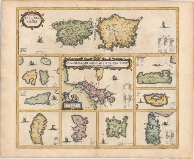
Subject: Mediterranean Islands

Period: 1657 (published)

Publication: Accuratissima Orbis Antiqui Delineatio…

Color: Hand Color

Size:
19.4 x 16.9 inches
49.3 x 42.9 cm
Download High Resolution Image
(or just click on image to launch the Zoom viewer)

This sheet contains several maps of Mediterranean islands in classical times, all based in part on Ortelius. The central map [Euboea Insula] describes the Greek island Euboea and is surrounded by nine maps of other islands. This composition includes the islands of Sardinia and Corsica [Insularum Sardiniae et Corsicae Antiqua Descriptio] at top instead of Cyprus, as on Ortelius' map. Each shows tiny villages, rivers and mountains in profile and is decorated by sailing ships, except for Samos, which is adorned with a sea monster.

References: Van der Krogt (Vol. I) #7500H:1.

Condition: A

Very good with just a hint of toning.

Estimate: $650 - $750

Sold for: $500

Closed on 11/20/2013

Archived