Subject: Southern Europe
Period: 1730 (published)
Publication: Claudii Ptolemaei's Atlas Tabulae Geographicae Orbis Terrarum
Color: Hand Color
Size:
17.9 x 12.5 inches
45.5 x 31.8 cm
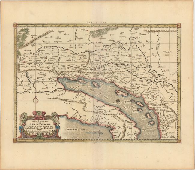
An attractive Ptolemaic map of the Balkan coast and northern Italy along the Adriatic Sea, extending north to include parts of Austria and Hungary. The map is embellished with a strapwork cartouche and a sea monster. Mercator originally published this map in his 1578 edition of Ptolemy's great Geography. Although he is most renowned today for the projection he popularized and for first using the term Atlas for a collection of maps, he devoted much of his life to his Ptolemaic maps. The maps were beautifully engraved as nearly as possible to their original form and embellished with fine cartouches. This is the third state with a re-engraved title cartouche and the addition of a grid, published by R. and J. Westenios and Guil. Smith. There is evidence of a crack in the plate at bottom adjacent to the sea monster.
References: Mickwitz & Miekkavaara #235-23; Van der Krogt (Vol. I) #0905:1.3.
Condition: A
Nice impression and color on watermarked paper with a printer's crease adjacent to centerfold and light toning along sheet edges, far from image.