Subject: Eastern Switzerland
Period: 1642 (circa)
Publication: Toonneel des Aerdrycx, oft Nieuwe Atlas
Color: Hand Color
Size:
19.7 x 15 inches
50 x 38.1 cm
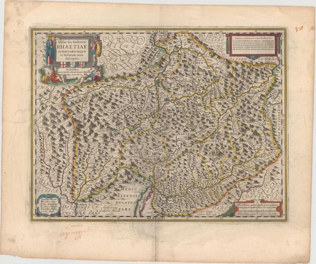
Handsome map of eastern Switzerland and northern Italy around Lake Como. The region is known as Graubunden, which was once part of a Roman province called Raetia. The map highlights the fortifications along the Adda River, as well as provides excellent information on the topography, cities and tiny villages throughout the region. Each corner of the map is adorned with a decorative cartouche. The title cartouche credits Philip Cluver and features a soldier and river gods, and the cartouche at top right dedicates the map to Hadrianus Pauw. Engraved by Evert Symonsz van Hamersveldt. Dutch text on verso, published between 1642-43.
References: Van der Krogt (Vol. II) #4940:2.2.
Condition: B+
Old color and wide margins with some printer's ink residue, marginal soiling, and an archivally repaired centerfold separation in bottom margin.