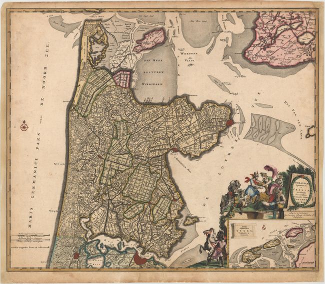
Subject: Central Netherlands
Period: 1680 (circa)
Publication:
Color: Hand Color
Size:
23.3 x 19.7 inches
59.2 x 50 cm
This attractive map depicts Amsterdam and the area directly to the north of the great city, extending to Den Helder. The tiny street patterns of the major cities are shown along with good detail of the surrounding provinces. At bottom right is an inset of the Wadden Islands from Texel to the tip of Ameland. The map is adorned with an allegorical title cartouche featuring Mercury, a satyr, and a river god.
References:
Condition: B
Lovely original color that has been partially refreshed, with light soiling and two small holes in unengraved areas that have been professionally repaired. There are light damp stains at far right and left, and the map has been remargined at right and left with neatline skillfully replaced in facsimile.