Subject: World
Period: 1780 (circa)
Publication:
Color: Hand Color
Size:
17.3 x 13.4 inches
43.9 x 34 cm
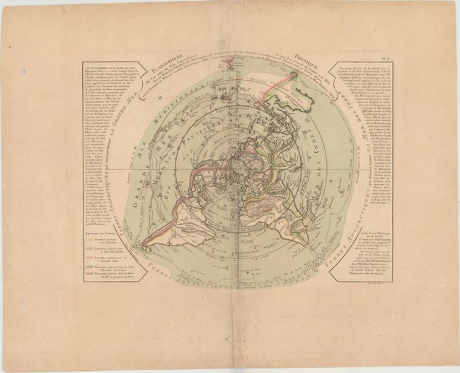
This is a scarce and very unusual thematic map designed to illustrate the watersheds of the world. The map is presented on a North Polar projection. Strong hachures show the major mountain ranges and color is used to depict the watershed for each of the oceans. In North America there is a large Sea of the West and a nearly complete Northwest Passage. Australia is still shown with a conjectural coastline, making it considerably too wide. The continent connects to both New Guinea and Terre du St. Esprit (the Land of the Holy Ghost), discovered by Queiroz. Engraved by Desbruslins.
References: Potter, pp.178-9 (illus); McGuirk #60.
Condition: B
Original color on watermarked paper with very generous margins, light toning, scattered foxing primarily confined to blank margins, and some creasing along the centerfold.