Catalog Archive
Auction 147, Lot 417

"Knapdalia Provincia, que sub Argathelia Censetur / The Province of Knapdail which is Accounted a Member of Argyll", Blaeu, Johannes

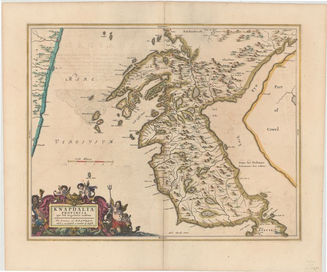
Subject: Western Scotland

Period: 1654 (published)

Publication: Theatrum Orbis Terrarum sive Atlas Novus

Color: Hand Color

Size:
21 x 16.6 inches
53.3 x 42.2 cm
Download High Resolution Image
(or just click on image to launch the Zoom viewer)

This finely engraved map depicts Knapdale, a rural district of Argyll and Bute in the Scottish Highlands, just west of Loch Fyne. The map, based on the work of Timothy Pont, famous surveyor of Scotland in the late sixteenth century, includes great detail of the rivers, cities, villages and castles. An elaborate title cartouche decorates the map, illustrated with putti, sea monsters and mer-people. Latin text on verso.

References: Van der Krogt (Vol. II) #5881:2.

Condition: B+

Attractive color and wide margins with light offsetting and some show-through of text on verso.

Estimate: $300 - $375

Sold for: $220

Closed on 11/20/2013

Archived