Subject: World
Period: 1779 (dated)
Publication:
Color: Hand Color
Size:
26.5 x 17.4 inches
67.3 x 44.2 cm
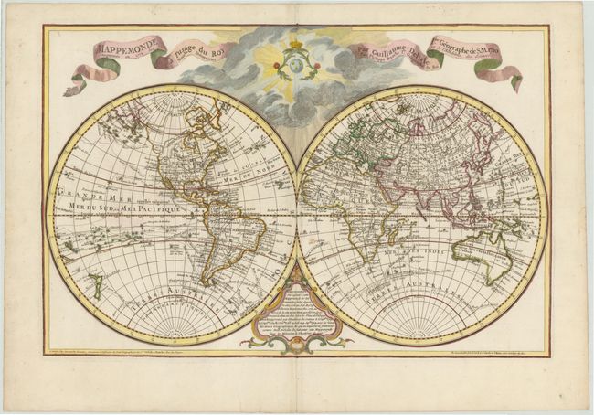
Dezauche, the successor to the Delisle cartographic firm, issued this impressive large double hemisphere map based upon the work of both Delisle and Bauche. The map shows well formed continents with the latest discoveries described in the cartouche at bottom. The western portion of North America is still largely blank with the exception of a large Mer de l'Ouest and a waterway labeled Gr de Eau that suggests a Northwest Passage. Alaska is shown in a rudimentary shape based on the discoveries of Captain Cook. Australia and New Zealand also reflect the discoveries of Captain Cook, whose routes are traced throughout the map, including several landfalls in Antarctica. The large title is in ribbon form, with a sun and clouds covering the upper portion of the map, and a decorative advertisement cartouche at bottom. This is the third state with the addition of the Gr de Eau.
References: McGuirk #44.
Condition: B+
Watermarked paper with a few small, unobtrusive spots and a couple tears in blank margins that have been archivally repaired.