Catalog Archive
Auction 147, Lot 405

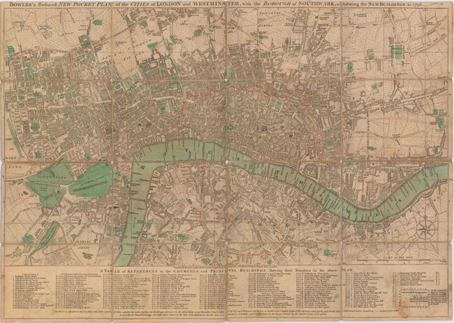
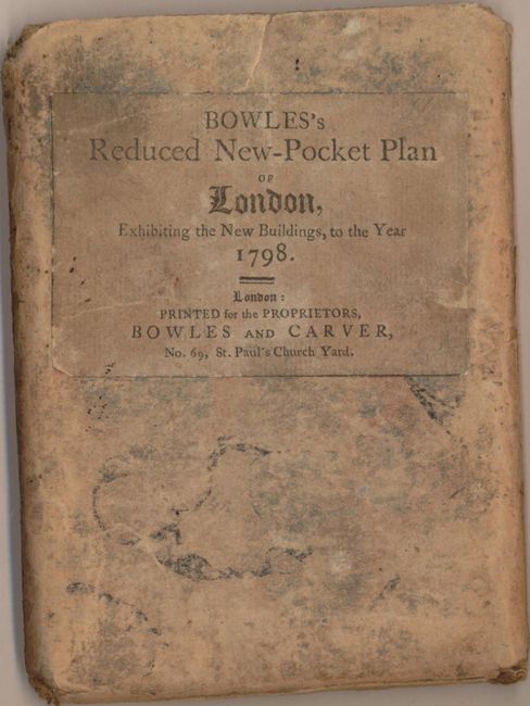
"Bowles's Reduced New Pocket Plan of the Cities of London and Westminster, with the Borough of Southwark, Exhibiting the New Buildings to 1798", Bowles & Carver

Subject: London, England

Period: 1798 (dated)

Publication:

Color: Hand Color

Size:
21.6 x 15 inches
54.9 x 38.1 cm
Download High Resolution Image
(or just click on image to launch the Zoom viewer)

This very detailed map of London and vicinity was published at the very end of the 18th century and covers the area from Knightsbridge east to Shadwell, and Islington south to Newington Butts. The densely filled map shows buildings, churches, roads and parks with a table at bottom keying 99 churches and 50 public buildings. Published by Bowles & Carver at No. 69 in St. Paul’s Church Yard. Dissected and backed in linen and folds into a tan paper case. This example is in between states 10 and 11 according to Howgego.

References: Howgego #168.

Condition: B

The linen has separated along several segments, but the map is still intact overall. Light toning with some soiling at bottom. Slip case is heavily worn, but also still intact.

Estimate: $600 - $750

Sold for: $450

Closed on 11/20/2013

Archived