Subject: World
Period: 1776 (dated)
Publication: Atlas Universel
Color: Hand Color
Size:
27.9 x 18.5 inches
70.9 x 47 cm
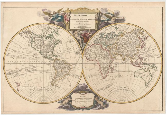
This lovely and decorative double-hemisphere map shows the tracks of the voyages of Bouvet de Lozier (1738-39) in the Antarctic and of Anson (1740-43) across the Pacific, along with the Manilla - Acapulco route of the Spanish galleons. It was Anson's capture of a richly laden galleon in 1743 that made his expedition so important in the annals of Pacific voyages. Australia is depicted with a conjectural coastline connected to Tasmania, and Terre de Diemen appears both in Tasmania and on the northern coast. In North America the Pacific Northwest is beginning to take shape with the additions of Admiral de Fonte's discoveries, although there are still numerous inaccuracies. A series of rivers and lakes appears to depict at least one Northwest Passage, including L. de Fonte, Gr. Riviere de l'Ouest, and Lac Bernarda. The map is decorated with an elaborate, figural cartouche that was designed by Cochin and engraved by Groux. The attribution cartouche at the bottom is flanked by putti and clouds. This is the third state with changes to the Pacific Northwest.
References: Pedley #8.
Condition: B+
Issued folding on watermarked paper with several short fold separations that have been professionally repaired. There is light soiling, a few light creases, and a 1" tear extending from centerfold towards South America that has also been professionally repaired.