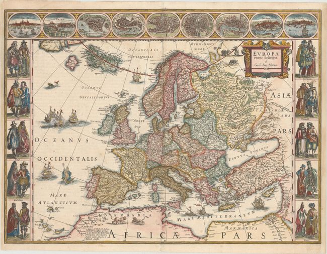
Subject: Europe
Period: 1640 (circa)
Publication: Theatrum Orbis Tarrarum
Color: Hand Color
Size:
22.1 x 16.4 inches
56.1 x 41.7 cm
This classic map of Europe is presented in the carte-de-figures style with vignettes on three sides. The upper frieze has nine bird's-eye views of Amsterdam, Prague, Constantinople, Venice, Rome, Paris, London, Toledo and Lisbon. The side borders contain the costumes of the noblemen and women of ten European nations. The map is embellished with sailing ships, sea monsters, bears and Neptune riding a dolphin and holding his trident. A beautiful map produced at the height of the Golden Age of Dutch mapmaking; it was included in the first volume of Blaeu's magnificent atlas. Latin text on verso, published between 1640-43.
References: Goss (Blaeu) #4, p.30; Van der Krogt (Vol. II) #1000:2.
Condition: B+
A dark impression on watermarked paper with professional repairs to separations along the centerfold and a 2" tear in image across top left corner. Also professionally remargined at right and left with a portion of border expertly replaced in facsimile at top left.