Subject: World
Period: 1748 (dated)
Publication:
Color: Black & White
Size:
27.5 x 19.8 inches
69.9 x 50.3 cm
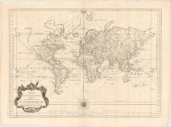
Early issue of this fine large world chart on Mercator's projection decorated with a large title cartouche and two compass roses. North America is shown with a very pronounced River of the West connecting through a series of rivers and lakes from Lake Superior to the Pacific - representing the elusive Northwest Passage. The Russian discoveries in the North Pacific are not yet shown, although there is a note about the voyages of 1743. Australia is labeled Nouvelle Hollande with Terre de Diemen and Nouv. Guinee both linked to the mainland. New Zealand is only partially formed and there are numerous islands in the Pacific.
References:
Condition: B+
Issued folding on watermarked paper with some faint toning, two tears near the lower compass rose that have been professionally repaired on verso, and a few tiny splits at fold intersections.