Catalog Archive
Auction 147, Lot 344

Manuscript Map

"Mapa Topografico de la Provincia de Sana en el Obispado de Truxillo en el Reino del Peru", Anon.

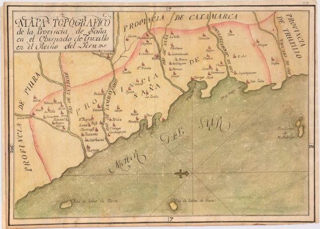
Subject: Northern Peru

Period: 1840 (circa)

Publication:

Color: Hand Color

Size:
15.8 x 11.2 inches
40.1 x 28.4 cm
Download High Resolution Image
(or just click on image to launch the Zoom viewer)

Manuscript map that shows the northwestern coast of Peru from the Piura region to today's La Libertad region, here called Provincia de Truxillo. Several towns are identified, with a small drawing of a building to denote each one. There is a fleur-de-lis in the Mar del Sur that orients north to the left, as wells as a few islands: Ysla de Lobos de Tierra, Ysla de Lobos de Fuera, and Farallones de Malabrigo.

References:

Condition: B

On watermarked paper with light scattered foxing and several tiny holes that are only visible when held up to light. The margin has been extended at left with old paper. Ex libris stamp on verso.

Estimate: $150 - $200

Sold for: $350

Closed on 11/20/2013

Archived