Subject: South America
Period: 1726 (circa)
Publication: Historia General de los Hechos de los Castellanos…
Color: Black & White
Size:
9.2 x 8.4 inches
23.4 x 21.3 cm
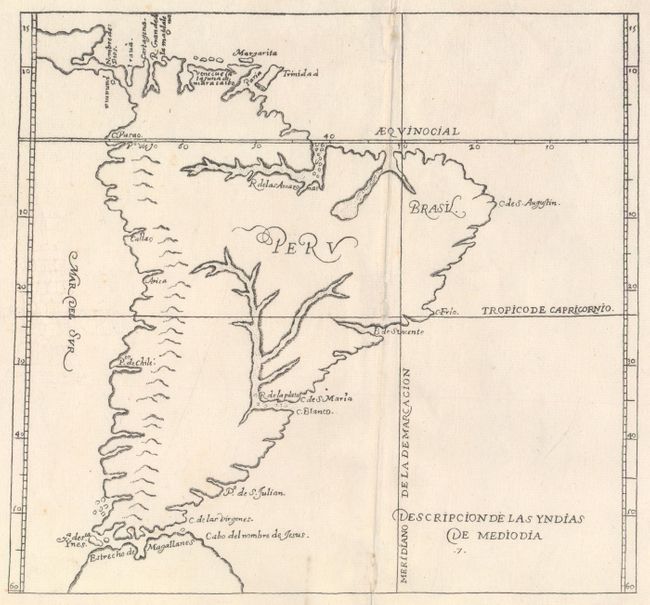
Antonio de Herrera Y Tordelisllas was the official historian of Spain and the Indies. He compiled a history of the Spanish conquests and early explorations in the Americas, which included this simply engraved map of the continent. His work (Historia general de los hechos de los Castellanos) was originally published in 1601 with several editions and translations thereafter, all of which are scarce. This map is from an early 18th century edition published by Nicolas Rodriguez. This rare map is largely derived from the manuscript charts of Juan Lopez de Velasco. The continent is dominated by the huge R. de los Amazona and R. de la Plato and the western mountain range. The Papal Line of Demarcation (Meridiano de la de Marcacion), which divided the non-Christian world between Spain and Portugal, divides the continent between Portugal’s tiny Brazil with the rest (Peru) belonging to Spain.
References:
Condition: B+
A nice impression on watermarked paper with generous margins. There are a few small worm holes along the centerfold that have been archivally repaired.