Subject: South America
Period: 1682 (published)
Publication: d'Onder-Aardse Weereld
Color: Hand Color
Size:
8 x 13.5 inches
20.3 x 34.3 cm
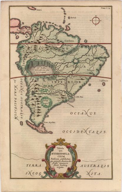
Very unusual map of South America from one of the first compilations of semi-scientific knowledge about the physical features of the world. The map is totally devoid of political detail with only a few regional names. Instead the map features the principal rivers, lakes, mountains and volcanoes. The mythical Lake Parime is here mistakenly linked to Lake Titicaca (Parime lacus, alias Titicacca). Paraquay is oddly depicted south of the Rio de la Plata (R. Della Plata), and a huge crater lake, more closely located to Lake Titicaca, is situated just above the Tropic of Capricorn. The Andes are shown as a chain of live volcanoes. The map is embellished with a large title cartouche at bottom. Published in a Dutch edition of Kircher's famous Subterranean World by Johann Waesberger.
References:
Condition: A
Marginal soiling.