Catalog Archive
Auction 147, Lot 298

"Map of the Leeward Islands; Comprising Antigua, Montserrat, Barbuda, St. Christopher, Nevis, Anguilla, Virgin Islands & Dominica...", Arrowsmith, John

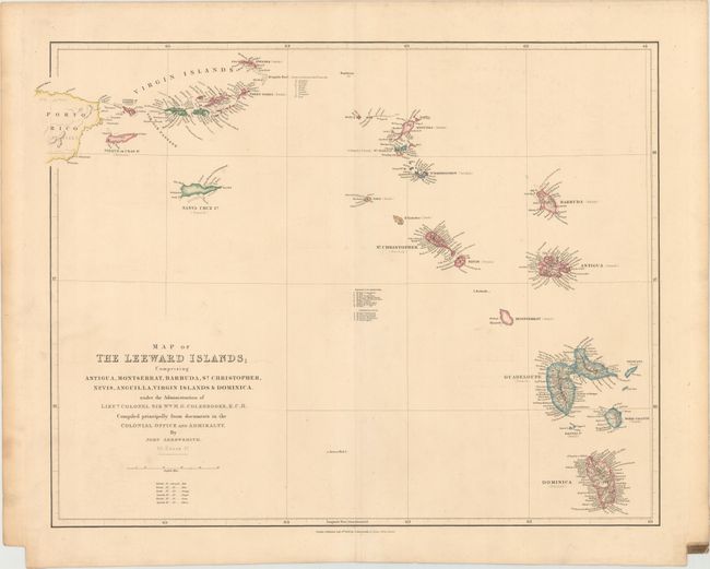
Subject: Leeward Islands

Period: 1839 (dated)

Publication: The London Atlas of Universal Geography

Color: Hand Color

Size:
23.9 x 18.4 inches
60.7 x 46.7 cm
Download High Resolution Image
(or just click on image to launch the Zoom viewer)

A precisely engraved map of the Leeward Islands extending from the eastern half of Puerto Rico to Dominica. The colonial interests are named for each island and keyed to a color legend. There is very fine detail along the coastlines of the major islands, and a table lists the parishes in Nevis and St. Christopher (St. Kitts). The title continues, "under the Administration of Lieut. Colonel Sir Wm. M.G. Colebrooke, K.C.H. Compiled principally from documents in the Colonial Office and Admiralty."

References:

Condition: B+

Original color with minor soiling and light offsetting.

Estimate: $275 - $350

Sold for: $200

Closed on 11/20/2013

Archived