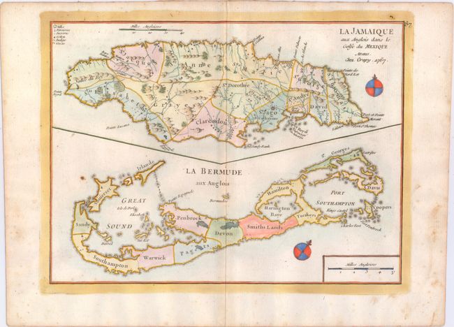
Subject: Jamaica, Bermuda
Period: 1767 (dated)
Publication: Atlas Nouveau Portatif
Color: Hand Color
Size:
10.7 x 7.9 inches
27.2 x 20.1 cm
This is a reissued map that was originally published by George Le Rouge in 1746. The sheet contains two maps, Jamaica above Bermuda. Jamaica is engraved to show the plantations, denoting those growing sugar, cotton, cacao, and indigo. The map of Bermuda includes an interesting cartographic error resulting from the copying John Speed's map of 1627. In that map, Bermuda was superimposed over a map of the coastline of New England and Virginia to show the relative position of Bermuda. Here, the coastlines of North America are gone, but the small depiction of an additional Bermuda remains, which appears on this map as a small offshore island named Bermudos.
References: MCC-19 #39.
Condition: B
On watermarked paper with faint toning along the centerfold and scattered light foxing, mostly confined to the blank margins. There is a piece of masking tape running across the top blank margin on verso.